Unprecedented Detail: The Most Precise Map of US Waters Ever Created
2025-01-23
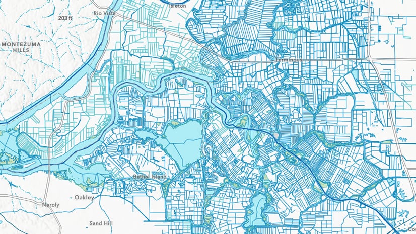
The US Geological Survey and its partners have unveiled the National Hydrography Dataset Plus High Resolution (NHDPlus High Resolution), the most detailed map of US waters ever produced. Boasting over 32 million features, this dataset offers an unprecedented level of detail, depicting rivers, lakes, wetlands, and more with rich attributes for mapping, analysis, and modeling. Now integrated into ArcGIS Living Atlas, this enhanced dataset provides seamless access and powerful capabilities, revolutionizing our understanding of US waterways and enabling advancements in hydrology research, environmental protection, and water resource management.